|

Check out our Western PA Counterpart!!
|
|
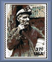
Sign the Coal Miner's Stamp Petition!
|
|
Eastern Coal Region Roundtable Website
|
|
|
Visit the Eastern Coal Region Roundtable Website for large collection of grant opportunities.
|
|
Mine Subsidence Insurance
|
|
|  |
EPCAMR Region GIS Coverages, Data Layers, Metadata
GIS Program -- Map Gallery -- Area of Service -- List of GIS Layers
GIS Program
EPCAMR Staff have been collecting Statewide GIS Data Layers to aide in assessing the environmental and economic effects of AMD impacted waters and AML scarred lands.
Maps and Diagrams Section of our Photo Gallery

Area of Service
EPCAMR Staff provides FREE GIS Mapping services to watersheds organizations, non-profits, reclamation-related groups, and municipalities that are impacted by AMD and or Abandoned Mine Lands in the in the EPCAMR Region. Qualifying areas must have at least 5% of their total watershed or municipality contained within an area impacted by Abandoned Mine Drainage or Abandoned Mine Lands. Areas with less than 5% AMD/AML impacts will incur charges to cover costs associated with staff time and production charges such as, creation, managment and dissemination of the digital geospatial data starting at a rate of $45/hr. Said customers may also more than likely recieve a lower priority for turnaround time on map printing and/or CD production.
We currently have a free program for municipalities which provides training on the use of GIS in Municipal planning. The program also provides large scale maps to municipal representatives that attend the workshops. Please see this article for more information about the program. This program was made possible through a grant from the National Fish and Wildlife Foundation.
Many of the conservation district in the EPCAMR Region may provide this type of assistance for free also. Please contact your county conservation district for more information. You may also want to visit our GIS Links page for additional GIS / GPS Assistance. For more information about Using GIS Technology for Abandoned Mine Reclamation please visit the Geospatial Conference Website
Below is a list of data layers are available in the EPCAMR LCD GIS Database. Individual data layer may be requested via e-mail and will be sent via e-mail from EPCAMR Staff. Files too large to be sent over the internet can be copied to CD and sent via snail mail (charges may apply). Many of these files may be downloaded through the PASDA Website.
EPCAMR / LCD Collection of Geographic Information Systems Data as of 4/2006 (approximately 34 GB)
Organized by : Geographic Boundaries --or-- Watershed Boundaries
General Notes about GIS Data - Data from a larger region can be clipped to a smaller region, but not vice versa. Clipped data may be less precise depending on the scale it was drawn at. Additional surveying may be needed for greater detail. Data is intended to be used for planning and educational uses only.
- Organized by Geographic Boundaries:
National
- Coal Seam Boundaries
- Shaded Relief
- Cities with 1998 Census Data (ESRI 2004)
- Agricultural Census by County (ESRI 2004)
- 108th US Congressional Districts
Pennsylvania
- County Boundaries (Penn DOT 2006)*
- State Boundaries (Penn DOT 2006)*
- “Municipal Boundaries” - Minor Civil Divisions (Penn DOT 2005)*
State Roads (Penn DOT 2005)*
- School District Boundaries (Penn DOT 2006)*
- Senate Boundaries (Penn DOT 2006)*
- House of Representatives Boundaries (Penn DOT 2006)*
- Digital Raster Grids (USGS Topo Quads 24K Scale)*
- Digital Elevation Models (USGS 1999 COunty Files)*
- Bedrock Geology (PA Geologic Survey 2001)*
- Glacial Border - Late Wisconsinan (PA Geologic Survey 1995)*
- Coal Mining Operations (PA DEP 2006)*
- Unsuitable Mining Areas (PA DEP 2002)*
- Small Forested Wetlands (GAP program)
- Exceptional Value Watersheds
- 303(d) List of Impaired Waters (PA DEP BWM November 2004)*
- AMD Impacted Waters (PA DEP BWM November 2004)
- Stormwater Watersheds - Act 176 (PA DEP 2002)*
- Flood Plane Boundaries (FEMA 2000)*
- Precipitation o Average (1961) o Yearly (1990) o Monthly (1990)
- County Parks (Point)*
- PA State Game Lands (PGC 2004)*
- PA State Forests (PA DCNR 2004)*
- Abandoned Mine Land Problem Area Polygons (PA DEP 2004)*
- Growing Greener Points (PA DEP 1991-2001)
- Networked Streams (PA DEP 1996)
- National Land Cover Dataset (PA Geo Survey 2000)*
- Major Watershed Boundaries (PA DEP)
- Small Watershed Boundaries (PA DEP)
EPCAMR Region
- Mine Pools and Drains of the Eastern Middle Anthracite Region (EMARR)
- AMD Anthracite Region Discharges (USGS 100 Greatest Discharges Report 1990)
- AMD Outfalls (Wilkes University data for Luzerne, Lackawanna and Schuylkill Counties)
- AMD Sludge Sampling Project Points and Tonnage Estimates (EPCAMR 2003)
- Anthracite Coal Fields (clipped from National Coal Seam Boundaries)*
- Watershed Organization Boundaries (EPCAMR 2005)
- Small Watershed Boundaries with RWSI Program Information (EPCAMR 2003)
- Local Roads (Merged from each County RDX flies)*
Luzerne County
- Digital Raster Grids (USGS Topo Quads)
- Digital Ortho Quads - Aerial Photos (Luzerne Co. 2000)
- Digital Ortho Quads - Color Aerial Photos (USDA 2004)
- National Wetlands Inventory
- Exceptional Watershed Boundaries
- Hydrology - Stream and Lake Outlines and Center Lines (Luzerne Co. 2000)
- Streams Chapter 93 Designation Added (EPCAMR 2003)
- Local Roads (Luzerne Co. 2000)
- Major Roads (Luzerne Co. 2000)
- Dirt and Gravel Roads (Luzerne CD 2002)
- Rail Roads - Active and Inactive Rail Trail Status
- County Soils (USDA)
- Soils Best Suited for Farming (Luzerne Co. 2004)
- Agricultural Security Areas (Luzerne Co. 2004)
- Preserved Farms (Luzerne CD 2004)
- Pipelines
- 500 ft Ridgelines Buffer
- Points of Historical Significance
- Natural Areas
- Stewardship Areas
- Agricultural Easements
- Conservation Easements
- Urban Areas
- Developed Areas
- Forested Areas
- Steep Slopes
- Proposed Open Space Areas
Lackawanna County
- Cropped Digital Elevation Model Raster
- Cropped Shaded Relief Raster
- 150 ft Stream Buffers
- Points of Historical Significance
- Lakes and Waterbodies
- Natural Stewardship Areas
- Rail Trails
- Reclaimed Minelands
- Proposed Open Space Areas
Schuylkill County
- County Soils (USDA)
- Parcels (Schuylkill Co. 2000)
- Deep Mines
- Surface Mines
- Geologic Formations
Columbia County
- Soils (USDA)
Susquehanna County
- Mines & Quarries - Active and Abandoned (Susquehanna CD 2002)
WPCAMR Region
- Counties
- Small Watersheds
- Organized by Watershed Boundaries:
Delaware River Basin
Lehigh River (Wildlands Conservancy 2000)
- 2004 303(d) list of Impaired Waters
- AMD Basins
- High Quality Cold Water Fishery, Exceptional Value, Chapter 93
- Streams
- Drinking Water Withdrawal
- Aquifers
- Dams
- Flood Prone Areas
- Groundwater Supplies (Points)
- Public Water Supplies (Points)
- River
- NPDES Points
- Small Watersheds (PA Gazetteer)
- AMD Discharges
- Abandoned Mines (Points)
- Coal Fields
- CERCLA Sites
- Forests
- Geologic Formations
- Physiographic Providences
- State Forests
- Soils
- Wetlands
- Mine Operations
- Abandoned Mine Lands (Polygons)
- Natural Areas
- Summits (Points)
- Cities (Points)
- Counties (Polygons)
- Towns (Points)
- Townships (Polygons)
- Urban Areas (Polygons)
- Highways
- Interstates
- Local & County Roads
- Major Roads
Susquehanna River Basin
- Hydrography Polygons - Lakes, Reservoirs, Rivers* (SRBC)
Catawissa Creek
- Watershed Boundary
- Fish Species Occurrence*
- Audenried & Green Mountain Discharges (Lines)
- Green Mountain Tunnel Wetland Plant Communities (EPCAMR 2004)
- Streams
- Roads
- 2004 303(d) list of Impaired Waters
- Municipal Boundaries
- AMD Outfalls
- Sample Points (Catawissa Creek Restoration Association)
- Schuylkill, Luzerne, Columbia Soils
Nescopeck Creek
- Jeddo Treatment Area Proposed (EPCAMR 2003)
- 2004 303(d) list of Impaired Waters
- Municipal Boundaries
- Roads
- Streams
Wyoming Valley Watershed
- Watershed Boundaries
- Macro-Invertebrate Identification Points (EPCAMR/OSM 2002)
Copyright © by EPCAMR All Right Reserved. Published on: 2003-12-17 (747 reads) [ Go Back ] |
|
|
|
 or
or  feeds
feeds


