|

Check out our Western PA Counterpart!!
|
|
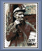
Sign the Coal Miner's Stamp Petition!
|
|
Eastern Coal Region Roundtable Website
|
|
|
Visit the Eastern Coal Region Roundtable Website for large collection of grant opportunities.
|
|
Mine Subsidence Insurance
|
|
|  |
GIS Mapping Support for Local Governments
August 2005 - August 2006
Update - 01/24/2006 - EPCAMR would like to provided technical assistance, GIS Mapping, education and outreach on abandoned mine land reclamation (AMLR) & abandoned mine drainage (AMD) remediation to municipalities in Eastern PA that are located within the Chesapeake Bay Watershed. We made a new position just for this project thanks to a generous grant form the National Fish and Wildlife Foundation. Rob Lavelle, EPCAMR Municipal GIS Technician is heading up the work. A similar program was piloted in Western PA by our sister organization, WPCAMR. With that experience they were able to develop a handbook called AMD in Your Community. Our assistance allowed local municipal leaders to develop integrated comprehensive watershed restoration and remediation plans that often became a subset each local government’s Comprehensive Land Use Plans. EPCAMR already has developed the PA DEP and other State & Federal Agencies, including the Office of Surface Mining, a Model Plan for Watershed Restoration involving abandoned mine lands
published and distributed to many watershed organizations across PA since 1999. EPCAMR will provided educational, hands-on, training workshops on the use of GIS Software and various extensions (i.e., ESRI’s ARCVIEW 3.3 and ARCVIEW 8.3) to enhance local municipal planning efforts in the field of AMLR & AMD remediation and will advocate for an efficient way to prioritize watershed projects that will support specific commitments identified in the Chesapeake 2000 Agreement. As emphasized in the Chesapeake 2000 Agreement, strong GIS systems are needed to track the preservation of resource and support the implementation of sound land use practices and plans.
Final Products
20 2-hr Workshops entitled, [Community Outreach on Abandoned Mine Reclamation for Chesapeake Bay Local Governments Using GIS in PA] were conducted by the EPCAMR Staff throughout the Chesapeake Bay Watershed, over a 1 year period; Workshops were coordinated in partnership with local municipalities throughout the EPCAMR Region that have direct impacts from abandoned mine lands and AMD; 5 hours of additional free follow-up assistance was allotted for the municipalities
3 Full Color, 42” wide AMLR GIS Base Maps of all identifiable NAMLIS and local abandoned mine land problem areas, features, potential redevelopment areas, recreational opportunities, available data layers, and historical preservation areas were produced for each of the municipalities who agree to provide the space (i.e., Municipal Building) to host each of the 20 Workshops;
Additional GIS Base Maps and technical assistance was produced and provided as a free service to municipalities, planning commissions, and Borough Councils, Township Supervisors, and zoning offices upon request and will be a secondary priority over the work necessary to complete the AMLR GIS Base Mapping for the host municipalities of the Workshops;
Distribution of Data Sources, Metadata, and Files on CD-ROM to all new partnerships established with local municipalities upon request for use on their existing GIS Workstations;
Continual posting of Data Sources, Metadata, and Files on the EPCAMR Web Site (www.orangewaternetwork.org)
A completed PowerPoint Presentation that will provide the necessary education and outreach tools, tips, tricks, and customizations of GIS Software in order to assist local municipal governments in developing their Comprehensive Watershed Restoration and Remediation Plans for AMLR;
Provided copies of the Chesapeake 2000 Agreement to all participants of the GIS Workshops and highlight the goals that are being emphasized throughout the project;
A complete list of attendees from each of the GIS Workshops was compiled by local government organizational types (i.e., planning commissions, zoning offices, supervisors, councilmen and women, business managers, road departments, recreational departments, sewer authorities, and GIS staff);
An account of the number of Comprehensive Watershed Restoration and Remediation Plans for AMLR started, just before the completion of the 1 year Project; Gathered through a survey of all participants who had attended any of the GIS Workshops prior to a final report being submitted to the NFWF and OSM; and
A complete list of local watershed organizations in the EPCAMR Region was provided to each of the municipalities involved in the GIS Workshops in order for them to call on their local volunteer community organizations to assist them in providing public input in developing the Comprehensive Watershed Restoration and Remediation Plans for AMLR.
For more information please contact Robert Hughes EPCAMR Regional Coordiantor for more details.
Copyright © by EPCAMR All Right Reserved. Published on: 2005-03-30 (532 reads) [ Go Back ] |
|
|
|
 or
or  feeds
feeds


